I though I would put together a little info on how to read the USGS stream flow data sites. I know there is a lot of us that understand them "for the most part" but this is for the newer river guys out there trying to make heads or tails of what took me 3+ years of reading, watching, studying different gauges in different times of the year to do. Hope it helps.
For this example I will use the two gauges I'm most familiar with.
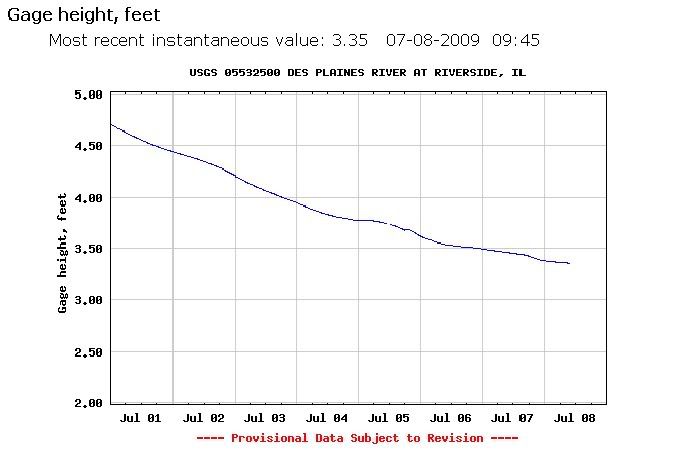
Des Plains River in Riverside. IL
The normal flow of this river is 3.50ft +/- a few 10ths. Now, that means where ever they put that particular gauge... On a bridge, near a dam wherever. It is just a set level of what is normal pool. So there it just so happens to be 3.50ft.
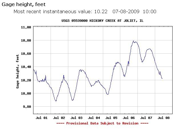
Hickory Creek in Joliet, IL
The normal flow of this creek is 10.50ft +/- a few 10ths. This gauge just so happens to be in a section of the river that has been dug out by man and it's flow controlled for new urban developments. I have walked this whole creek from it's source east of La Grange rd. to about a half a mile before it dumps into the Des Plains River. 95% of this creek is no deeper than your ankles and to your chest at most the other 5%. So seeing the 10.50ft number should not scare you away.
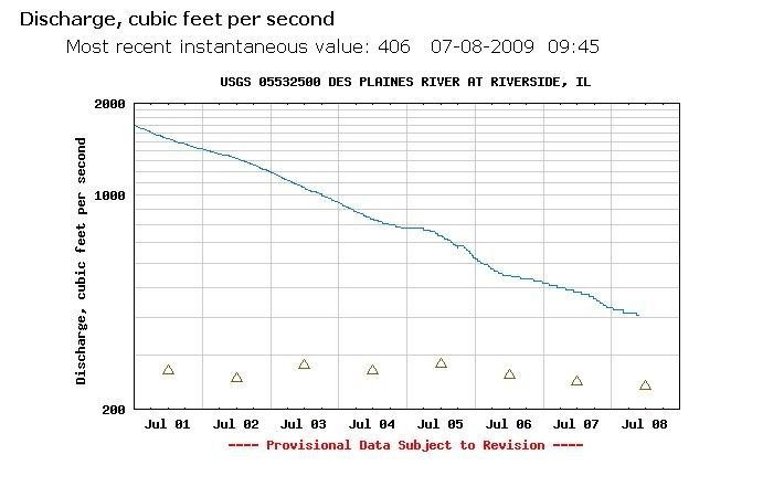
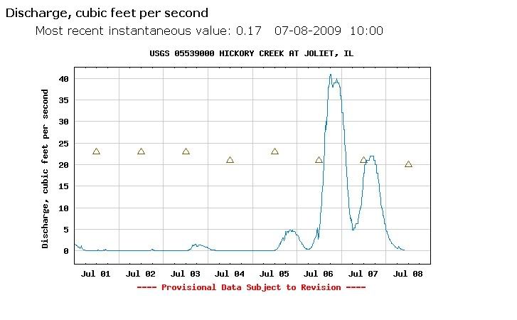
Cubic Feet Per Second gauge.
This is the gauge you should use most often. The higher the number the stronger the flow and normally the bigger body of water.
Des Plains River in Riverside. IL
This gauge should read 400cfps +/- a few 10ths in normal conditions. Now, If you have seen the gauge at 3.50ft you know that it cfps should be 400. Right! It's is a more accurate way to know how the river is before you travel. I myself always check both before going out and I would advise the same.
Hickory Creek in Joliet, IL
This creek flows at 40cfps +/- a few 10ths at normal pool. This image was taken in low water conditions. So 0.17cfps is barley moving but 117cfps is going to be a problem wading this creek. The smaller the body of water the more rain/run off will affect it's level more so.
Your best bet is always check the gauges before you go out and make a mental note of river heights and flows. I feel that if I had a tool such as this I would have got into the rivers much sooner! Again, Getting out there is always the best way to go! Just be safe doing it:) I am going to put together a small library for us river guys to always have a place to archive our data. If you any questions feel free to ask!
Thanks,
Dan Sims
